Photos from my first research cruise to deploy nitrate monitoring instruments into the Bering Sea aboard the NOAA vessel, Miller Freeman. Sept. 17-30.

Bird's eye view of the brilliant colors of the Birch and Aspen around Fairbanks.

Mt. Redoubt volcano, flying from Anchorage to Dutch Harbor.
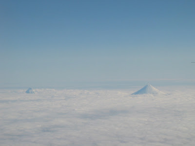
Beautiful strato volcanoes poking up above the clouds along the Alaska Peninsula. In the foreground is Mt. Shishaldin at 9372 ft, the highest and most active volcano in the Aleutian volcanic arc. The dormant volcano in the distance is Isanotski Peaks at 8025 ft, the second highest peak in the Aleutian arc. Both peaks are on Unimak Island.

Map of Aleutian Island Chain. There are some 300 islands along the chain that extend 1,200 miles from the Alaska Peninsula towards the Kamchatka Peninsula in Russia. There are 57 volcanos along the chain. They are the westernmost and eastern most points of the US, because some of the islands are across 180 degrees longitude. Amazingly all of the islands use Alaska Standard Time, when several time zones should really be used to reflect the distance covered. Prior to 1983 Alaska had 3 times zones, one for the SE panhandle, one for the central part, and one for the west coast/aleutian chain. I pulled the following from Wikipedia:

360 view of Dutch Harbor/Unalaska. There are two towns here, connected by a bridge. Unalaska is to the far left and far right in this picture. Dutch Harbor is where most of the ship activity is. This is the busiest and most productive fishing harbor in the USA. For the past 18 years this port has had the highest tonnage of fish and shellfish pass thru its docks. In 2006 it was 911 million pounds (455,000 tons). Its value was second in the nation at $165 million dollars.
There is alot of history here. There has been evidence of a human presence dating back 9,000 years. The Russians were the first westerners to arrive in the mid-1700's. The well protected harbor was quickly realized by Russian captains. Around 1765 the Russians established a permanent settlement. Capt. James Cook stopped in 1778. There were 2000 native Aleuts on Unalaska Island at the time. The Russian Orthodox church built a church in 1825 which still stands today.
Unalaska served vessels involved in the fur trade, whaling, and fishing and also as a port for the gold mining activity in Nome and the Yukon River. River boats were built here in the late 1800's to ply the waters of the Yukon River. Strange place to do it, but this was probably the closest deep water port to the mouth of the Yukon where large items could be easily shipped from ports in the lower-48 to build the large river boats.
The US Navy began building a submarine and seaplane base in 1940. The Japanese conducted an air raid on the Navy installation on June 3 and 4, 1942. 42 military and 1 civilian deaths occurred and 50 wounded.

Today many remnants of WW II military activity can seen; gun emplacements, tunnels, trenches, magazines, bunkhouses and other buildings. There is no longer an active military presence here. The main activity is fishing and crabbing. The full-time population is about 4,500 but this number can nearly triple from August to May when commercial fishing is busiest.

View of Pyramid Mtn from the dock that the Miller Freeman was tied up to. I hiked up this Mtn one afternoon before the ship left. It took about 2.5 hours to get from the dock to the top. Beautiful views from atop. I picked blueberries on my way down.

Fireweed gone to their autumn color.

Alpine tundra plants gone to autumn color.

Grass above the alpine tundra. Strange?

View of Dutch Harbor in background and Unalaska in foreground. You can see the bridge that connects the two islands. The airport is at the base of the large hill in the center background.

360 view atop Pyramid Mtn

Captains Bay. The Miller Freeman is tied up at the dock in the center of the photo.

High bush blueberries

Purple hands.

We left the dock on Tues. the 18th and spent the day just outside the harbor waiting for a storm further north to blow our of the area we were headed for.
Table Top and Sugarloaf Mtn from left to right. Both are inactive volcanoes.

Looking to the northeast up the Aleutian Chain.

Beautiful sheer cliffs. These islands are all volcanic in origin. The Aleutian Chain being the meeting point of the Pacific oceanic plate and the North American continental plate.

Beautiful hanging valley. A glacier formed this U-shaped valley.

Another glacial valley.

Yet another hanging valley along the same stretch of coastline as the previous 2 photos, all within 2 miles.

Bird's eye view of the brilliant colors of the Birch and Aspen around Fairbanks.

Mt. Redoubt volcano, flying from Anchorage to Dutch Harbor.

Beautiful strato volcanoes poking up above the clouds along the Alaska Peninsula. In the foreground is Mt. Shishaldin at 9372 ft, the highest and most active volcano in the Aleutian volcanic arc. The dormant volcano in the distance is Isanotski Peaks at 8025 ft, the second highest peak in the Aleutian arc. Both peaks are on Unimak Island.

Map of Aleutian Island Chain. There are some 300 islands along the chain that extend 1,200 miles from the Alaska Peninsula towards the Kamchatka Peninsula in Russia. There are 57 volcanos along the chain. They are the westernmost and eastern most points of the US, because some of the islands are across 180 degrees longitude. Amazingly all of the islands use Alaska Standard Time, when several time zones should really be used to reflect the distance covered. Prior to 1983 Alaska had 3 times zones, one for the SE panhandle, one for the central part, and one for the west coast/aleutian chain. I pulled the following from Wikipedia:
The Alaska Time Zone is applied to the territory of the state of Alaska to the east of 169° 30' W. Given that the UTC-9 time corresponds to the solar time at 9 x 15° = 135° W (roughly, Juneau), the westernmost locales where Alaska time gets applied are off by 169° 30' - 135° = 34° 30' from their 'physical' time. This means that when a clock correctly set to Alaskan time, at a location just east of 169° 30' W, shows noon, the 'physical' time is actually just 9:42 am. When UTC-8 is applied in the summer, this effect becomes even more apparent, since the solar time at Fresno, California (~120° W) is used. At a (say) July noon, the physical time at the extreme westerly points of the Alaskan time zone will actually be only 8:42 am.
In Anchorage, visitors from more southerly latitudes are often surprised to see the sun set at 11:41 pm on the summer solstice, but the actual 'physical time' is 9:41 pm. This is due to the fact that at 150° W, Anchorage is a full solar hour behind the legal time zone and observes daylight saving time as well. Some local residents refer to this phenomenon as "double daylight time". In Fairbanks, the same circumstances cause sunset to occur at 12:47 am on the next calendar day. In the winter, even without daylight saving time, another anomaly is that on the winter solstice in Nome, the sunrise is actually after "noon" clock time, at 12:02 pm lasting for about 3 hours before sunset.
360 view of Dutch Harbor/Unalaska. There are two towns here, connected by a bridge. Unalaska is to the far left and far right in this picture. Dutch Harbor is where most of the ship activity is. This is the busiest and most productive fishing harbor in the USA. For the past 18 years this port has had the highest tonnage of fish and shellfish pass thru its docks. In 2006 it was 911 million pounds (455,000 tons). Its value was second in the nation at $165 million dollars.
There is alot of history here. There has been evidence of a human presence dating back 9,000 years. The Russians were the first westerners to arrive in the mid-1700's. The well protected harbor was quickly realized by Russian captains. Around 1765 the Russians established a permanent settlement. Capt. James Cook stopped in 1778. There were 2000 native Aleuts on Unalaska Island at the time. The Russian Orthodox church built a church in 1825 which still stands today.
Unalaska served vessels involved in the fur trade, whaling, and fishing and also as a port for the gold mining activity in Nome and the Yukon River. River boats were built here in the late 1800's to ply the waters of the Yukon River. Strange place to do it, but this was probably the closest deep water port to the mouth of the Yukon where large items could be easily shipped from ports in the lower-48 to build the large river boats.
The US Navy began building a submarine and seaplane base in 1940. The Japanese conducted an air raid on the Navy installation on June 3 and 4, 1942. 42 military and 1 civilian deaths occurred and 50 wounded.

Today many remnants of WW II military activity can seen; gun emplacements, tunnels, trenches, magazines, bunkhouses and other buildings. There is no longer an active military presence here. The main activity is fishing and crabbing. The full-time population is about 4,500 but this number can nearly triple from August to May when commercial fishing is busiest.

View of Pyramid Mtn from the dock that the Miller Freeman was tied up to. I hiked up this Mtn one afternoon before the ship left. It took about 2.5 hours to get from the dock to the top. Beautiful views from atop. I picked blueberries on my way down.

Fireweed gone to their autumn color.

Alpine tundra plants gone to autumn color.

Grass above the alpine tundra. Strange?

View of Dutch Harbor in background and Unalaska in foreground. You can see the bridge that connects the two islands. The airport is at the base of the large hill in the center background.

360 view atop Pyramid Mtn
Captains Bay. The Miller Freeman is tied up at the dock in the center of the photo.

High bush blueberries

Purple hands.

We left the dock on Tues. the 18th and spent the day just outside the harbor waiting for a storm further north to blow our of the area we were headed for.
Table Top and Sugarloaf Mtn from left to right. Both are inactive volcanoes.

Looking to the northeast up the Aleutian Chain.

Beautiful sheer cliffs. These islands are all volcanic in origin. The Aleutian Chain being the meeting point of the Pacific oceanic plate and the North American continental plate.

Beautiful hanging valley. A glacier formed this U-shaped valley.

Another glacial valley.

Yet another hanging valley along the same stretch of coastline as the previous 2 photos, all within 2 miles.


